


 Regione: SICILY
Capo Granitola Observatory
Measurement site description: Capo Granitola
Lat : 37.5753N, Lon : 12.6595E
The Environmental-Climatic Observatory Capo Granitola is located at the Torretta Granitola coastal site (12 km from Mazzara del Vallo and 65 km south-east from Marettimo), within the CNR -IAMC campus. At this Observatory continuous (24/24 and 7/7) atmospheric compoisition measurements are carried out: it is well representative of the western Sicily/central Mediterranean basin conditions.
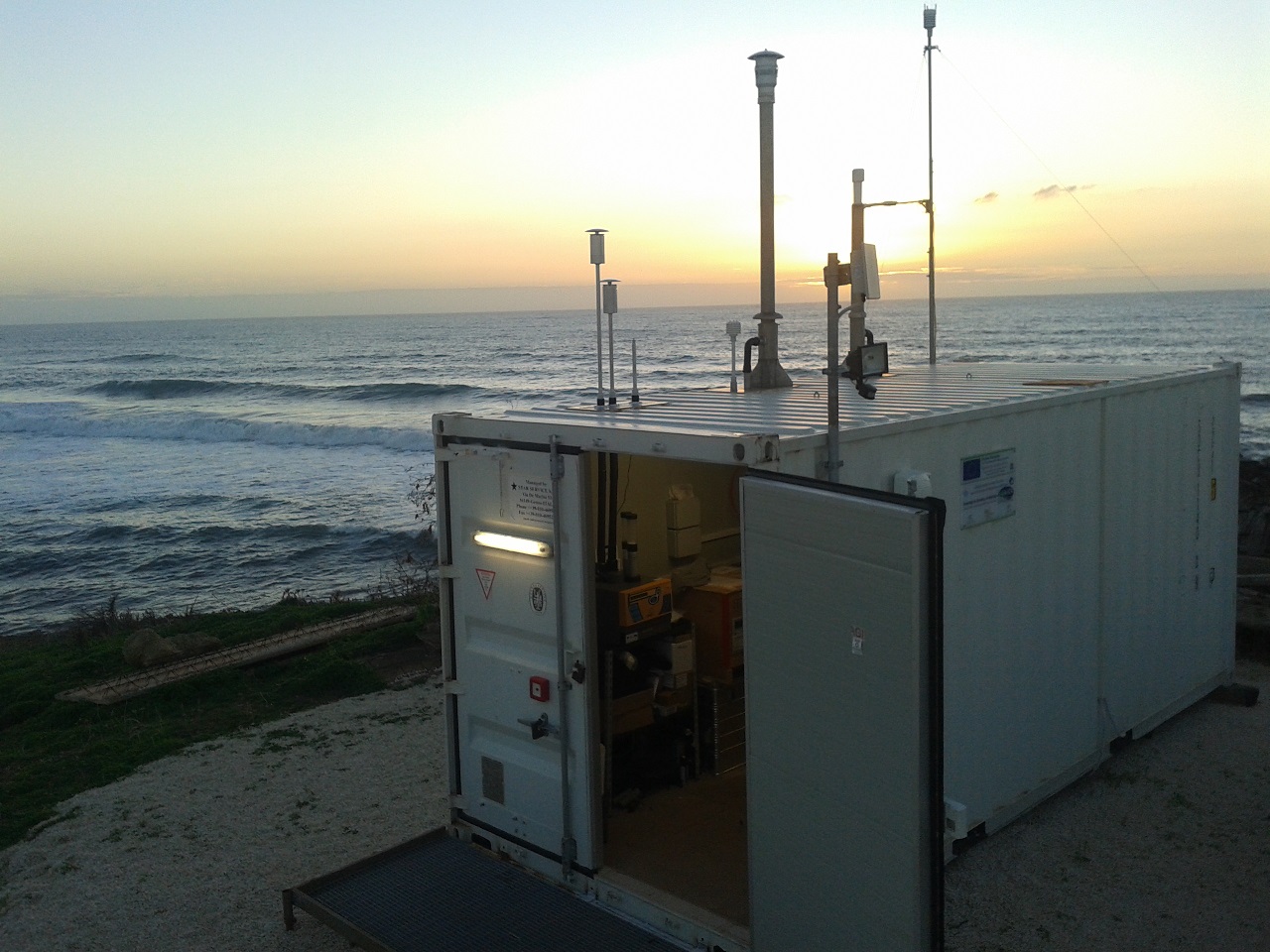
The Observatory is located at the coast-line towards the Strait of Sicily: it is able to catch information about the background conditions of the Mediterranean basin, besides providing useful hints to investigate the influence of specific atmospheric processes (e.g., long-rage air-mass transport, mineral dust emitted from northern Africa, anthropogenic ship emissions) on the variability of trace gases and aerosol.
In the framework of I-AMICA, the following measurement programmes have been activated:
- Meteo parameters and solar radiation
- Surface ozone and sulphur dioxide
- Carbon monoxide, carbon dioxide, methane
- Nitrogen oxides (NO and NO2)
- Aerosol number size distribution (particles from 280 nm to 10 micron)
- Aerosol mass (PM2.5 and PM10)
- Equivalent black carbon concentration and aerosol absorption coefficient
- Aerosol scattering coefficient at three wavelenghts
- Integrated aerosol particle counting (for particles with 4μm lowest diameter).
Moreover, at the Marettimo Island, where specific field campaigns can be carried out, meteorological paremeters are continuously observed. The Observatory is equipped with devices for the near-real time data delivery, allowing for a timely identification of special atmospheric events or instrumental malfunctioning.
Study of atmospheric circulation:
In order to have a preliminary description of atmospheric circulation at Granitola, the retro-trajectory HYSPLIT model has been used, taking into consideration NCEP-GDAS meteorological data, for the time period 2006 – 2011. To this end, and for the entire analysis period, daily retro-trajectories have been created whose length equaled 120 hours. In Picture MA-2 the frequency field of all calculated trajectories can be seen, per so that to know where air masses come from, since air masses can influence atmospheric composition by this site.

Picture MA-1: Frequency field of retro-trajectories calculated for Marettimo from 2006 – 2011. The colors indicate frequency values (%) of trajectories on the 1°x 1° grid
Description of measurement site: Marettimo
Position: Lat: 38°0N, Long: 12°1E, 50 m asl
The Marettimo Island is located on the western area of the Egadi Islands. The island’s population is around 800 people. The closest and most relevant city centers are Trapani (around 70,000 inhabitants) and Marsala (around 82,000 inhabitants), both 40 km East.
At Marettimo, an automatic weather station continously provides data about air-temperature, atmospheric composition, relative humidity, wind direction and speed, rainfall.

Picture MA-2: Satellite image of the Marettimo Island. The red box indicates Marettimo’s inhabited areas, the green box indicates Punta Libeccio and the blue one indicates Punta Troia (from: Google Map).
References:
Draxler, R.R., and G.D. Hess, 1997: Description of the HYSPLIT_4 modeling system. NOAA Tech. Memo. ERL ARL-224, NOAA Air Resources Laboratory, Silver Spring, MD, 24 pp.
